Some products begin with a pitch deck. LocoPast began with a habit.
Wherever I went - a new city abroad, a work trip, a coastal weekend, or a simple lunch break in London - I kept asking the same question: what happened here? Not the broad strokes you skim in a guidebook, but the specific stories tied to the street corner in front of me. The sort of detail that changes how you look at a building, or why a road bends, or what a view once meant.
The frustrating part was never a lack of history. The internet is full of it. The frustrating part was that it was scattered and de-spatialised. You could read about an artist, a riot, a scientific breakthrough, or an infamous scandal - but you rarely saw it anchored to the exact place you were standing. The map was missing.
That missing map is the reason LocoPast exists. It is a Location-Based History App built around a simple idea: history is geographic before it is abstract. If a story happened, it happened somewhere - and that somewhere is often still walkable.
The idea behind LocoPast: history on the ground, not in a textbook
Traditional history tools tend to pull you away from the street. They encourage you to read about a place from afar, then maybe visit a handful of headline sights. That approach works if you only care about the top three monuments. It does not work if what you really want is density - the feeling that an ordinary neighbourhood is layered with meaning.
LocoPast flips the relationship between place and story:
- You start with where you are (or a place you search for).
- The app reveals stories tied to real coordinates.
- You read one, look up, walk a little, and do it again.
The result is a different kind of exploration. It is less like consuming a timeline and more like walking through an archive that has been pinned to the map.
What the app offers, in plain language
LocoPast is designed to be fast and usable in the moment. It is not meant to be a deep research database. It is a tool for noticing.
When you open the app, you can:
- Reveal history near you using GPS, so the map responds to where you are standing.
- Search anywhere in the world, even if you are planning a trip from your sofa.
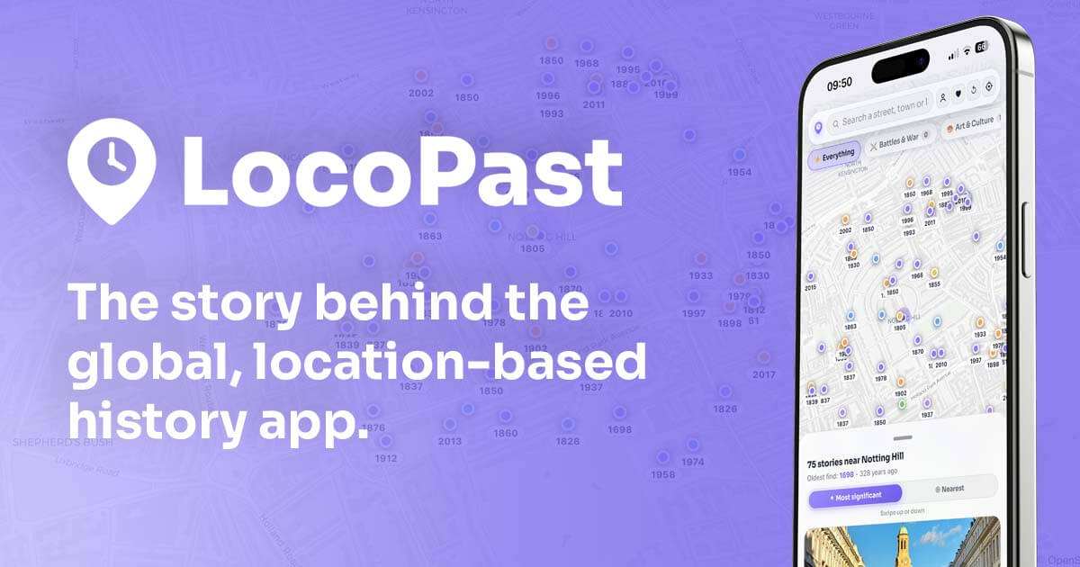
- See stories as pins on a live map, so you understand what happened where.
- Filter by topic using colour-coded chips (from battles and politics to art, crime, disasters, industry and more).
- Sort stories by significance or distance, depending on whether you want the biggest moments or the closest ones.
- Tap through to the full source article for a deeper read.
- Save favourites with ♡ (with a free account) so you can build a personal collection.
- Share a location link so a friend can open the same view on their own device.
None of this requires you to memorise names or chase a chronology. You simply stand somewhere interesting and start exploring.
A few feature insights that change how you use it
The best way to understand LocoPast is to use it like a walker, not like a reader. A few patterns make the app feel noticeably richer.
Pan and zoom like you are scanning for signal
LocoPast is built around map interaction. When you pan across a district or zoom into a single block, the view updates to match. Think of it as scanning the terrain for narrative: move the map a few streets at a time and see which pockets suddenly become dense with pins.
This is especially useful in older cities. The difference between a busy modern shopping street and a quieter lane behind it can be dramatic. The app helps you find those lanes.
Use topic filters to build a theme walk in minutes
If you open the map without filters, you will see a mixed spread. That is good for serendipity, but filters are what turn the experience into a coherent walk.
Try these simple pairings:
- Architecture + industry to read a neighbourhood as a sequence of buildings and uses.
- Politics + crime to find stories of power, protest, and scandal.
- Art + science to uncover studios, institutions, and invention hotspots.
Once you choose a theme, you do not need a formal itinerary. The pins are the itinerary.
Save as you go, then revisit like a personal atlas
Saving is not just bookmarking. It is how you build continuity.
The first time you walk an area, you will miss things. The second time, you will remember the saved pins and start noticing physical details that match the stories - an odd wall line, a rebuilt facade, a street name that sounds older than it should. Over time, your saved list becomes a small, personal atlas of understood ground.
Share links as micro-guides
History is often best as a short message: "Look at this - you will not believe what happened here."
Because each spot can be shared as a link, LocoPast works as a lightweight guide you can send to friends. Instead of trying to explain a story in a paragraph, you can send the location and let the map do the work.
Examples: how people actually use LocoPast
The app is simple, but the use cases are surprisingly varied. Here are a few that come up again and again.
City breaks: replace generic "top ten" lists with a story-first wander
Land in a new city, open the app near your hotel, and let the surrounding pins shape your first walk. You will still pass famous sites, but you will also pick up smaller stories that make the city feel more lived-in: a street known for printing, a building that hosted a political moment, a square that shifted purpose over centuries.
If you want a quick benchmark for density, open a well-known anchor like Tower of London and explore outward a few streets at a time.
Neighbourhood walks: make familiar streets strange again
The most satisfying use case is your own patch. When you discover that an ordinary junction once sat on a boundary line, or that a quiet mews used to be part of an industrial yard, you start seeing your commute differently.
The key is to move slowly. Read one pin, look up, then walk to the next pin without staring at your phone the whole way. Let the story guide what you look for on the street.
Planning a route: build a themed walk before you leave the house
Because search works anywhere, you can plan a walk in advance. Pick a starting point (a station, a park gate, a museum), choose two topic filters, and save a handful of pins along a rough line. Then, on the day, you follow the line with room for detours.
That planning style works particularly well for visitors who want a tour feel without the group - and for locals who want a structured way to explore beyond the obvious high street.
Where the history comes from, and why that matters
LocoPast draws on geotagged stories and pins them to coordinates, then ranks and categorises them so they are usable on a map. The point is not to replace deep research or local archive work. The point is to make discovery easy.
The best way to treat the app is as an accelerator. It gives you leads. When a pin grabs you, click through, read, and then keep going - or cross-check with a local plaque, a borough heritage page, or a specialist book if you want to go deeper.
If you want to try it, start with one habit
You do not need a grand itinerary to get value from a location-based history app. You need a single habit:
- Stand somewhere you already know.
- Open LocoPast.
- Read one story.
- Look up and find one physical detail that makes the story feel real.
- Walk a hundred metres and repeat.
If you want a ready-made starting point, open LocoPast in your browser, search for somewhere familiar, and filter by one topic that genuinely interests you. Within a few minutes, the map starts to feel like a new sense - the ability to see the past as something distributed across streets, not locked inside dates.