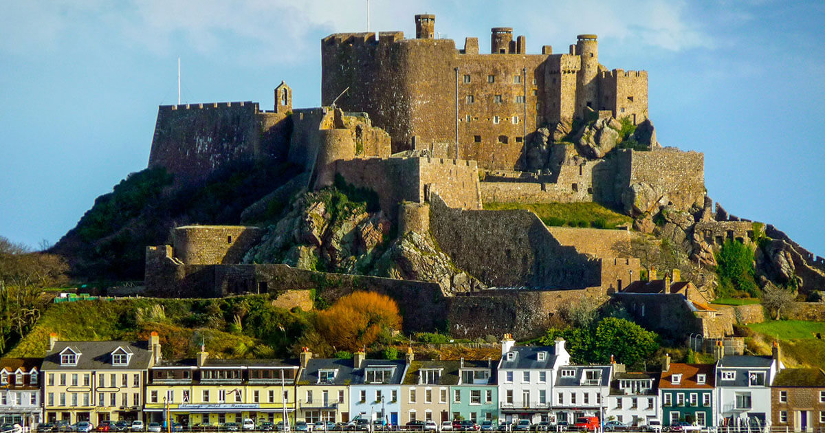
The Channel Islands sit in the Gulf of Saint-Malo, geographically closer to Normandy than to mainland Britain, yet politically tied to the British Crown for centuries. Jersey, Guernsey, Alderney, Sark, and Herm each developed distinct customs, laws, and landscapes. Their shared story is one of maritime position: exposed to tides, trade, privateering, and invasion, yet stubbornly local in government and identity. To understand the islands is to understand a corner of Europe that never quite chose a simple nationality.
Before the dukes: prehistoric and Roman edges
People lived on these islands long before medieval politics named them. Megalithic tombs, standing stones, and coastal settlements show communities that used the sea as a highway rather than a barrier. Rising sea levels after the last Ice Age gradually separated the islands from the continental shelf, creating the tidal races and reefs that still shape navigation today.
Roman influence reached the region through trade and coastal control rather than through grand urban foundations on every island. Later centuries brought Frankish and then Viking pressures to the Norman coast. By the time Normandy emerged as a powerful duchy, the islands were drawn into a world of seafaring lords, ecclesiastical ties, and defended harbours. The deep past matters because it explains a habit of self-reliance: islanders learned early that help from a distant capital arrives slowly when the tide and weather disagree.
1066 and the Norman bond
When William, Duke of Normandy, conquered England, the Channel Islands belonged to his Norman world. After later kings of England lost mainland Normandy, the islands remained attached to the English Crown. That political twist is the root of their special status. They are not colonies in the ordinary sense, nor ordinary English counties. They became Crown Dependencies with their own legal traditions, assemblies, and relationships to the sovereign.
Jersey and Guernsey developed separate bailiwicks. Local seigneurs held rights over land and courts. Customary law, influenced by Norman practice, continued to evolve. French remained important in administration and daily speech for a long time, especially in rural parishes. English grew in influence through trade, garrison life, and later tourism, but the islands never became linguistic or cultural photocopies of southern England. Walking older parish churches and manor sites, you still feel that hybrid inheritance.
Fortresses, privateers, and the long French threat
For centuries, the islands' strategic value was obvious to anyone with a chart. They offered sheltered roads for shipping, bases for privateering in wartime, and forward positions watching the French coast. Castle Cornet in Guernsey, Mont Orgueil and Elizabeth Castle in Jersey, and the dense Victorian and earlier fortifications of Alderney all speak to that nervous geography.
Wars with France repeatedly tested island defences. Raids, garrison politics, and the cost of maintaining walls shaped local society. Maritime fortunes rose and fell with conflict. Privateering could enrich captains and merchants; blockade and impressment could empty harbours. The islands' prosperity was never only agricultural. It was commercial, opportunistic, and closely tied to the state of the Channel.
Parish life remained the social backbone. Farming, fishing, cider, and later specialist crops such as Jersey potatoes organised the rural year. Towns concentrated markets, shipping agents, and the offices of island government. The contrast between granite farmsteads and busy harbours is still one of the pleasures of travelling here: two economies sharing one shoreline.
Victorian transformation and island character
The nineteenth century brought steam packets, improved harbours, tourism, and a thicker overlay of British military engineering. Alderney in particular became a heavily fortified outpost. Guernsey and Jersey welcomed visitors seeking mild winters, coastal walks, and a flavour of abroad without a long continental journey. Hotels, promenades, and guidebooks began to package the islands for leisure as well as strategy.
Yet modernisation did not erase local difference. Sark retained a distinctive seigneurial system into the modern era. Herm stayed small and carefully managed. Each island guarded its own institutions. That patchwork is essential to Channel Islands history: "the islands" is a useful phrase, but Jersey is not Guernsey, and neither is a suburb of the other. Travellers who hop between them quickly notice changes in accent, administration, and even the feel of the high street.
Occupation: the Second World War
The German occupation of the Channel Islands remains the most heavily visited and emotionally charged chapter of modern island history. After the British government demilitarised the islands, German forces arrived and established a long occupation. Fortifications mushroomed - bunkers, gun batteries, tunnels, and labour camps - especially on Jersey, Guernsey, and Alderney. Forced labour, deportations, rationing, and the pressures of collaboration and resistance left deep marks on families and landscapes.
Liberation brought celebration and hard reckonings. Museums, preserved bunkers, and memorials now interpret this period with care, though debates about memory continue. For many visitors, a bunker in the dunes or a wartime tunnel is their first serious encounter with occupation on British soil. The Channel Islands force that recognition: the war was not only "over there". It was here, in parish lanes and harbour offices, for years.
When you stand on those concrete remains, it helps to widen the frame beyond a single fortification. LocoPast can sit alongside museum visits by showing nearby pins - older castles, parish churches, and harbour stories - so the occupation layer does not float free of the deeper island timeline. Try starting around Castle Cornet in Guernsey, or explore Jersey's seaward defences near Elizabeth Castle, then walk outward into the town streets that had to live with garrison rule.
After liberation: finance, farming, and identity
Post-war recovery rebuilt tourism and agriculture while new economic specialisms emerged, particularly finance and related professional services in Jersey and Guernsey. Debates about regulation, fairness, and island autonomy are part of contemporary politics; they also continue a much older theme: how small jurisdictions manage relationships with larger neighbours.
Cultural identity remains actively tended. Norman French dialects survive in fragments and revival projects. Local artists, historians, and heritage bodies document parish life, maritime trades, and wartime experience. Food culture - from seafood to island dairy - carries pride of place. The landscape itself is curated through cliff paths, tidal causeways, and carefully protected green lanes that still feel agricultural rather than purely scenic.
How to read the islands on foot
A useful way to approach Channel Islands history is by layers rather than by celebrity sites alone:
- Tidal edge: harbours, slipways, coastal towers, and the daily negotiation with the sea.
- Parish core: churches, manors, cider presses, and field patterns.
- Military crust: medieval castles, Georgian batteries, Victorian forts, and occupation bunkers.
- Town modernity: markets, Victorian hotels, and the offices of island government.
Spend at least a day in one bailiwick before hopping to another. Ferry and flight connections make island-hopping tempting; slower travel makes the differences legible. Talk to local museums before you chase every bunker on a map. Context turns concrete into history.
Why the Channel Islands still matter
These islands complicate simple maps of Britain and France. They show how medieval inheritance can survive into modern constitutional life. They preserve a wartime story that mainland Britain sometimes underplays. They demonstrate how small communities maintain legal and cultural distinctiveness within a larger Crown framework.
Above all, they reward attentive travel. The Channel is not a backdrop; it is the main character - the reason for forts, the engine of trade, the cause of isolation, and the source of beauty. Walk a cliff path at low tide, watch the water uncover reefs, and the islands' long history feels less like a list of dates and more like a continuing argument with the sea.