You are standing somewhere ordinary. A pavement, a car park, a park bench, a hotel lobby doorway. Nothing looks like a museum. Yet the ground under your shoes has almost certainly hosted markets, arguments, floods, celebrations, demolitions, and quiet lives that never made a guidebook. The question "what happened here?" is not reserved for battlefields and palaces. It is the most useful question you can ask on any walk.
Hidden history is not secret in the conspiratorial sense. It is simply history that is not labelled. Plaques are selective. Tourist maps favour photogenic ruins. Everyday streets keep their stories in fabric, names, and documents that most people never open. Learning to find those stories turns travel and commuting into the same skill: reading place.
Look before you search
Start with your eyes. Buildings are documents written in brick, timber, and concrete. An uneven roofline often means centuries of extension. A stone ground floor under a timber upper storey can mark a rebuild after fire. Bricked-up windows, blocked doorways, and mismatched window sizes are clues that a façade has been altered while older structure survives behind.
Stand still for thirty seconds and inventory what you can see without a phone:
- What is the oldest-looking material within ten metres?
- Does the street widen or narrow suddenly?
- Are there steps, slopes, or retaining walls that feel older than the shops?
- Can you see a church tower, chimney stack, or warehouse roof that the modern street ignores?
Those answers give you a hypothesis. A sudden widening may be a former market. A kink in the road may follow a vanished wall or stream. A church that sits oddly relative to the street grid often predates the surrounding houses.
Read names as compressed history
Street names, pub names, and field names are short archives. "Gate" may mean a town gate. "Chester", "caster", and "cester" often signal Roman fortified sites. "Mill Lane", "Tan Yard", and "Ropewalk" point to industries that shaped the neighbourhood long after the workshops closed. River names and hill names survive even when the water is culverted and the hill is built over.
Do not treat every folk etymology as fact. Names get romanticised. Still, a cluster of industrial names on one side of town and ecclesiastical names on another is a reliable map of how the place once worked. Compare the names you see with a historical map later; the match rate is often high enough to feel like solving a puzzle.
Use maps as time machines
A modern map shows you how to arrive. An older map shows you why the place looks the way it does. Tithe maps, estate plans, Ordnance Survey sheets, and town atlases reveal vanished lanes, filled docks, demolished courts, and field boundaries that still organise property lines.
Before a walk, spend ten minutes with one historical map of the area. Mark three things that no longer exist: a gate, a stream, a building. Then walk to those coordinates and look for residual clues - a gap between buildings, a dip in the pavement, a wall stub, a name on a modern sign. The absence becomes visible once you know what to miss.
If you are abroad, national mapping agencies and municipal archives often publish free scans. You do not need perfect language skills to compare shapes. A wall is a wall. A harbour outline is a harbour outline.
Ask who lived and worked here
Architecture and maps tell you about structures. People tell you about meaning. Trade directories list who occupied a shop in a given year. Census returns and parish registers place families on streets. Local newspapers record fires, openings, disputes, and festivals with addresses attached.
You will not do deep archival work on every corner. You can, however, adopt a lighter habit: pick one building and ask what it was fifty and one hundred and fifty years ago. A charity shop may have been a bank. A flat conversion may have been a school. A car park may cover a burial ground or a canal basin. That single question, repeated, trains your eye for reuse.
Local museums and history societies are generous with this kind of knowledge. Ask which street they would walk if they had an hour free. The answer is rarely the postcard view.
Layer stories instead of chasing one famous event
A common trap is to hunt a single dramatic moment - a siege, a royal visit, a bombing - and ignore everything else. Places accrue layers. A Roman road becomes a medieval high street, then a Victorian shopping parade, then a pedestrianised centre. Each phase leaves traces if you look for them.
Try themes rather than a single date: defence, worship, trade, industry, migration, leisure. One square can hold all six. Themed looking keeps you from rushing between isolated "sights" and helps you see how ordinary residents lived alongside headline events.
Let location tools answer the immediate question
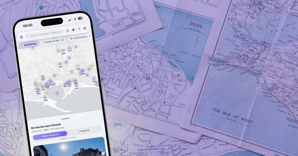
When you are already on the pavement, desk research is too slow. You want something that responds to the coordinate under your feet. That is where LocoPast fits the "what happened here?" habit. Open the app where you are standing and stories appear pinned to that position - not a generic city overview, but events and places tied to the map around you.
Use it mid-walk rather than only at famous monuments. Some of the richest material sits on unremarkable streets: a former workhouse site, a rebuilt pub after a raid, a quay where people left for new lives. Pause, read, look up, and take ten steps to see the same façade from the angle the story describes.
Combine the app with your own notes. If a story mentions a demolished gate, mark it. If two events share a street decades apart, you start to feel density - the stacked past that makes urban walking addictive. For a dense practice ground, open Tower of London and walk outward a few streets at a time, or browse York Minster when you want a clear example of layered civic history.
A five-minute field routine
You do not need a free afternoon. Try this on a lunch break or while waiting for a train:
- Face the oldest-looking structure you can see and name three materials or features.
- Read every street and building name within sight.
- Open a historical map or LocoPast and find one vanished or transformed feature nearby.
- Walk to that feature and look for physical corroboration.
- Write one sentence: "This place was once X; now it is Y."
Repeat the routine in a new neighbourhood and you will notice how quickly your sense of "ordinary" changes.
Respect the living place
Hidden history includes homes, workplaces, and sacred sites still in use. Looking from the public pavement is enough. Do not trespass for a better photograph. Do not treat occupied buildings as abandoned sets. The goal is understanding, not access at any cost.
Be careful with sensitive histories too - burial grounds, sites of violence, places of forced labour. Curiosity should come with care. Local interpretation boards and museum guidance help you approach difficult pasts without turning them into spectacle.
Make the habit travel with you
The same method works in a village, a capital, a coastal path, or a suburb. Terrain still matters. Names still compress history. Maps still expose vanished lines. Location tools still answer the immediate question when you are already there.
Start where you are this weekend. Ask what happened here. Then ask what happened ten metres away. The past is not locked in famous destinations. It is distributed across the ground you already walk - waiting for someone to stop, look up, and find it.